SPOT 6-7 | Launch of the 2026 National Coverage
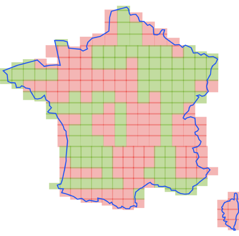
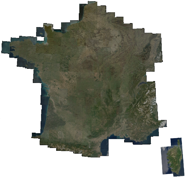
As has been the case every year since 2015, the SPOT 6 acquisition campaign for metropolitan France at 1.5-meter spatial resolution has begun. This year, the first acquisition attempts began […]
DINAMIS—the French national facility for institutional procurement of VHR satellite imagery—is a platform that acquires and distributes satellite Earth imagery for French and foreign institutional users under specific subscription conditions.
The platform aims to further institutional uptake of satellite data for programmes in the public interest in fields such as the environment, education and development of innovative services for:
• Research and development: fundamental and applied research, early-stage development and demonstration phases
• Land management and planning
• Environmental monitoring and management
• Innovative products & services
DINAMIS provides access to a bouquet of very-high-resolution commercial optical satellite data and its associated services.
News
As has been the case every year since 2015, the SPOT 6 acquisition campaign for metropolitan France at 1.5-meter spatial resolution has begun. This year, the first acquisition attempts began […]
News
The coverage of metropolitan France acquired in 2025 at very high spatial resolution by Spot 6 is available online in the DINAMIS website catalog. There are a total of 240 […]

News
This major upgrade represents a significant milestone in our commitment to enhancing your user experience by delivering expanded services through a simplified and modernized interface. A Unified and Intuitive Interface […]