
SPOT 6-7 | Launch of the 2026 National Coverage
As has been the case every year since 2015, the SPOT 6 acquisition campaign for metropolitan France at 1.5-meter spatial resolution has begun.
This year, the first acquisition attempts began on March 1, 2026.
After 8 weeks of planning and data acquisition, 111 of the 240 grid cells that make up the territory have already been acquired.
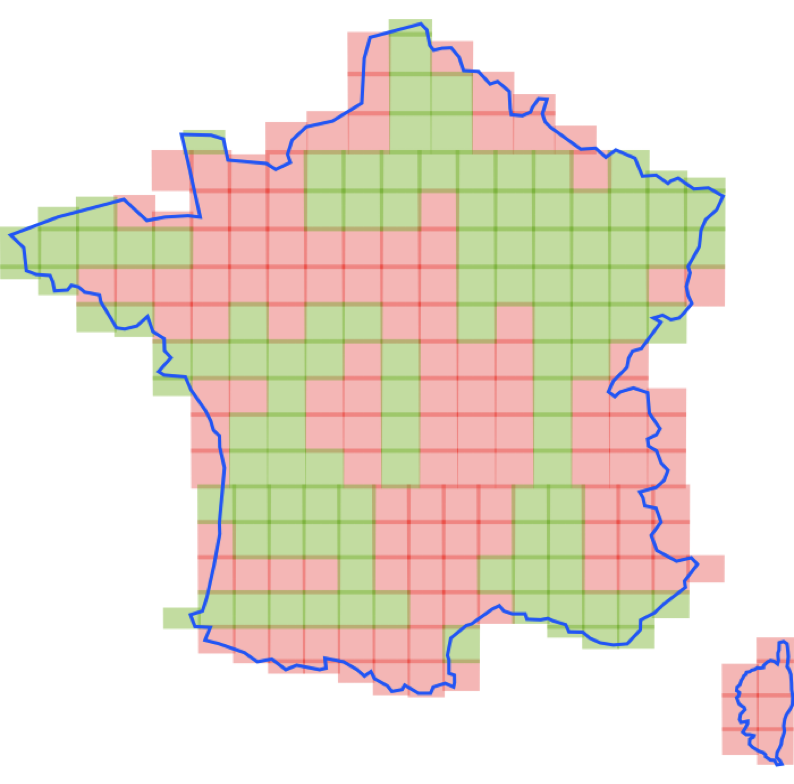
Launched in 2011, the initiative to cover all of metropolitan France annually aims to support research needs and provide tailored solutions for public policies related to land use planning and environmental monitoring.
Once the entire 2026 Spot 6 coverage is complete, the products will then be sent to IGN for bulk orthorectification to make them RGE®-compatible (Large-Scale Reference System)
Pending the delivery of the 2026 data set, the orthorectified Spot 6 products generated using the Dinamis Multi-Mission terminal in Montpellier (IGN references) will be made available online in the DINAMIS catalog.

