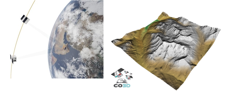
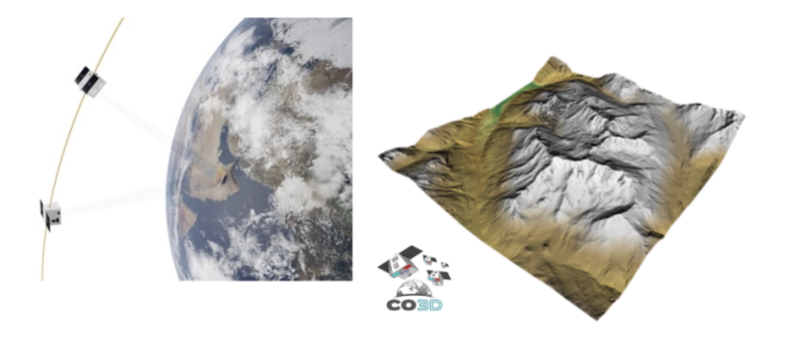
Launch of the CO3D Satellite Mission
The constellation of four CO3D satellites will launch from Kourou aboard the Vega C launcher on July 25. This represents a significant milestone for DINAMIS, as CO3D will strengthen the program’s Very High Resolution imagery offering. The platform will provide authorized institutional users with 600,000 km² of free DSM (Digital Surface Model) products annually and negotiated rates of approximately €0.50 per km² beyond the free quota. The 3D product will include images in perfect sensor format used to generate 3D data as well as ortho-images on demand.
Following the launch, a waiting period of several months will be required for orbital positioning, in-flight image quality testing, and system performance qualification. Starting around mid-2026, the new DINAMIS imagery request interface will enable users to submit archive production requests from L0 products in the catalog of already acquired products, as well as new programming requests. Similar to Pléiades, an annual quota system per user and per project will be implemented to ensure the most equitable response to user needs.
As a reminder, the four CO3D (Optical 3D Constellation) satellites are small satellites designed to map the globe in 3D. The CO3D mission aims to provide a global Digital Surface Model of land masses, with metric relative altimetric accuracy and 4 meters absolute accuracy. This precision is achieved through stereo acquisitions obtained from a new generation constellation of optical satellites providing 50 cm resolution color imagery in visible blue, green, red, and near-infrared bands.
This innovative system, characterized by its very high altimetric precision, flexibility, and strong revisit capacity, will support various studies related to climate change challenges. Two complementary missions are better than one… CO3D’s co-passenger on this flight will be the MICROCARB satellite, which will also contribute to better understanding our planet by measuring atmospheric CO2.